NOW ON TESTFLIGHT · v1.1.0
RANGEDOPE
Long-range ballistic solver & hunt planner. Built for the high country.
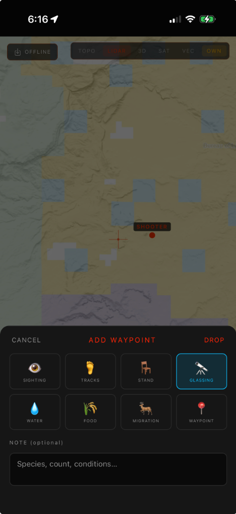
AZM: 247.8°
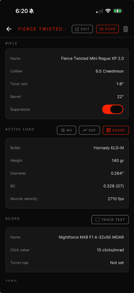
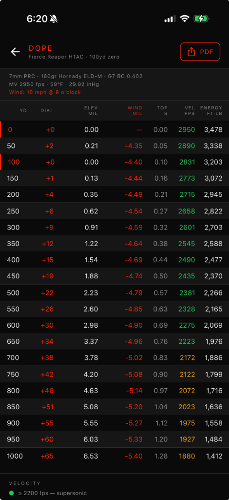
ELV: +1.45 MIL
TMP: 42°F
ELV: +1.45 MIL
TMP: 42°F
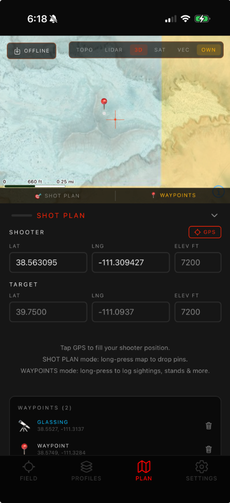
LAT: 38.56° N
LON: 111.09° W
ALT: 7,200 FT
LON: 111.09° W
ALT: 7,200 FT